


EATON Voting District, Lawrence County, Arkansas
About
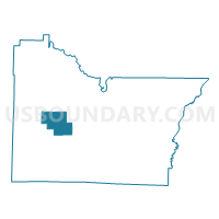
Outline

Summary
| Unique Area Identifier | 527053 |
| Name | EATON Voting District |
| County | Lawrence County |
| State | Arkansas |
| Area (square miles) | 15.58 |
| Land Area (square miles) | 15.53 |
| Water Area (square miles) | 0.05 |
| % of Land Area | 99.70 |
| % of Water Area | 0.30 |
| Latitude of the Internal Point | 36.03940490 |
| Longtitude of the Internal Point | -91.21381020 |
Maps


Graphs
Select a template below for downloading or customizing gragh for EATON Voting District, Lawrence County, Arkansas


Neighbors
Neighoring Voting District (by Name) Neighboring Voting District on the Map
- BLACK RIVER Voting District, Lawrence County, AR
- FLAT CREEK Voting District, Lawrence County, AR
- JESUP Voting District, Lawrence County, AR
- MORGAN Voting District, Lawrence County, AR
- STRAWBERRY Voting District, Lawrence County, AR
Top 10 Neighboring County Subdivision (by Population) Neighboring County Subdivision on the Map
- Morgan township, Lawrence County, AR (562)
- Black River township, Lawrence County, AR (533)
- Strawberry township, Lawrence County, AR (374)
- Eaton township, Lawrence County, AR (307)
- Jesup township, Lawrence County, AR (177)
- Flat Creek township, Lawrence County, AR (128)